Hello time traveller!!
This article is 2712 days old.
The information listed below is likely outdated and has been preserved for archival purposes.

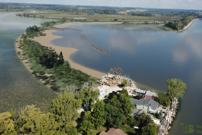
Flood damage on Pulley Road
Rain, wind and waves caused severe flooding and extensive damage to houses along the eastern shores of the Municipality of Leamington, Sunday.
Flooding caused significant shoreline damage and erosion after east/northeast winds with sustained speeds of 25 to 45 km/hr and gusts to 65 km/hr.
Article Continues Below Local Sponsor Message

The hardest hit areas included the entire east shoreline of the Municipality of Leamington between Wheatley Harbour and Point Pelee National Park.

Flood damage on Pulley Road

Flood damage on Pulley Road

Barricades block a previously flooded stretch of Lakeshore Road
Article Continues Below Local Sponsor Message

Water receding after it covered Cotterie Park Road


A field east of Mersea Road 21 is completely flooded

Flood damage on Cotterie Park Road


Flood damage on Silver Avenue

Julien Avenue is completely flooded
Content Continues Below Local Sponsor Message

